


Why Use MapBuilder?
MapBuilder is an easy-to-use tool that helps you build your own mapping application, complete with powerful analytical tools and core WRI data layers. A MapBuilder map can be built in as little as fifteen minutes by following our tutorials, and by using open-source code, anyone can customize the application to fit their needs.
With MapBuilder, you can integrate your own data layers into an interactive map to create a custom mapping application, or if you do not have your own data, you can use global datasets from Resource Watch and Global Forest Watch to create a map focused on your geographic area of interest.
To get started creating your own MapBuilder map, complete the steps below by following the instructions found on the Tutorial page.

MapBuilder Features
Data Options
To add your own data into MapBuilder, you can either upload your own files directly to ArcGIS Online, or you can add items from a URL that reference items from ArcGIS Server, KMLs, GeoJSONs, OGC feature layers, WFS, WMS, or WMTS (tutorials available here).
MapBuilder is compatible with the following types of data layers:
- Tile
- Web tile
- Image
- Dynamic
- Feature
- WMS
- Remote data layers
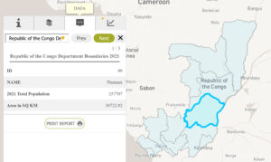
You can also add multimedia content to your datasets and reports. Compatible formats include:
Pictures
- jpg
- jpeg
- png
- webp
Videos
- mp4
- mov
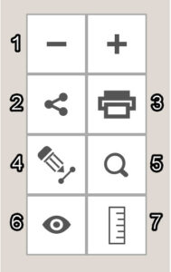
Here's an example
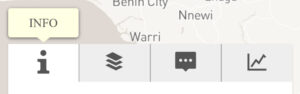
The information tab contains the description of your MapBuilder map. You can edit this text through the configuration form.
Advanced Settings
After using the configuration form, your MapBuilder map is ready to use! Just follow the directions to copy the JSON and paste it into the application. If you would like to do more advanced configuration, you can edit the JSON directly. The configuration options are listed below, and details on each element can be found on the MapBuilder GitHub page.
Plain Attribute Settings:
- Webmap ID
- Title, subtitle
- Logo URL, logo link URL, about link URL, download link URL, print service URL
- Map theme IDs, map themes
- Narrative
- Hide header/footer/legend Custom color theme
- Include MyGFW login
- Open links in new tab
- URL for host sharing
- Initial map extent
- Load Google Analytics Script
- Footer links
- Language settings
- Include documents tab in application
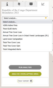
- Turn GFW layers on/off
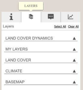
Layer Panel Settings:
- Group types
- Group order
- Group label
- Group layers
- Layer label language
- Layer ID
- Layer order
- Layer type
- Label
- Service URL
- Opacity
- Technical name for GFW Metadata API Visible
- Legend Layer
- Popup
- Dashboard Icon
The Configuration Form
The configuration form is a quick and easy way to set up your MapBuilder map. You can enter your information into the configuration form to create a JSON file that is used to structure your MapBuilder map. The configuration form has four pages to:
- Set general settings (title, subtitle, adding in your map)
- Add in global datasets from WRI
- Add an alternative language
- Set advanced settings (page analytics etc.)
Once your MapBuilder map is up and running, you can return to the configuration form at any time to edit the parameters of your application. Additionally, if there are any elements of your MapBuilder map that you would like to customize further, there is a GitHub library detailing how to edit the JSON. See the ‘Advanced Configuration’ section for more information.
Customization Guide

| Configuration Form Page | Item |
|---|---|
| General Settings | A. ArcGIS Online Webmap URL/ID |
| B. Title for your map | |
| C. Subtitle for your map | |
| D. Title for the menu of map | |
| E. Narrative about your map to give users insights about it | |
| F. URL to your map logo | |
| G. URL for the "About" tab | |
| H. URL for "Download Data" tab | |
| Layer/Analysis Settings | I. Climate datasets from GFW |
| J. Landcover datasets from GFW | |
| K. Landcover dynamics datasets from GFW | |
| L. ISO Alpha-3 for your mask layer (masks all other countries) | |
| Alternative Language Settings | M. Include additional language (additional language title, subtitle, title for menu, and narrative) |
| Advanced Settings | N. Include myGFW login and alert subscriptions |
| O. Header | |
| P. Footer |